
A welcome break from the wind, decreasing chances of rain and warmer temperatures are forecast across the Greater Outer Banks for the second half of the Memorial Day holiday weekend.
But it will likely still not be the best conditions to sit on the beach, and definitely too dangerous to take a swim in the ocean.
Pesky low pressure off the southeastern U.S. has slowly drifted inland, after nearly a week of onshore flow that brought unseasonably cool temperatures, breezy conditions and rough surf along the Outer Banks.
NO SWIMMING flags are up on the Outer Banks. Feels more like the off-season than the start of summer.#ncwx pic.twitter.com/jt6z5VtaRf
— SamWalkerOBXNews.com🎙📻📰🥍🦓 (@SamWalkerOBX) May 27, 2023

Despite the fact that the system had all the look and feel of something tropical, less than a week before the start of the 2023 Atlantic hurricane season, the National Weather Service in Newport said on Saturday that’s not the case.
Wind, Rain, Waves, and Rips. Besides sounding like a 🔥 mixtape, it is also what we are experiencing this weekend in ENC.
It looks like a TC, walks like a TC, and quacks (maybe not) like a TC, so why isn't it a TC? Check out below 👇 #ncwx pic.twitter.com/pEhMO6DmEf— NWS Newport/Morehead (@NWSMoreheadCity) May 27, 2023
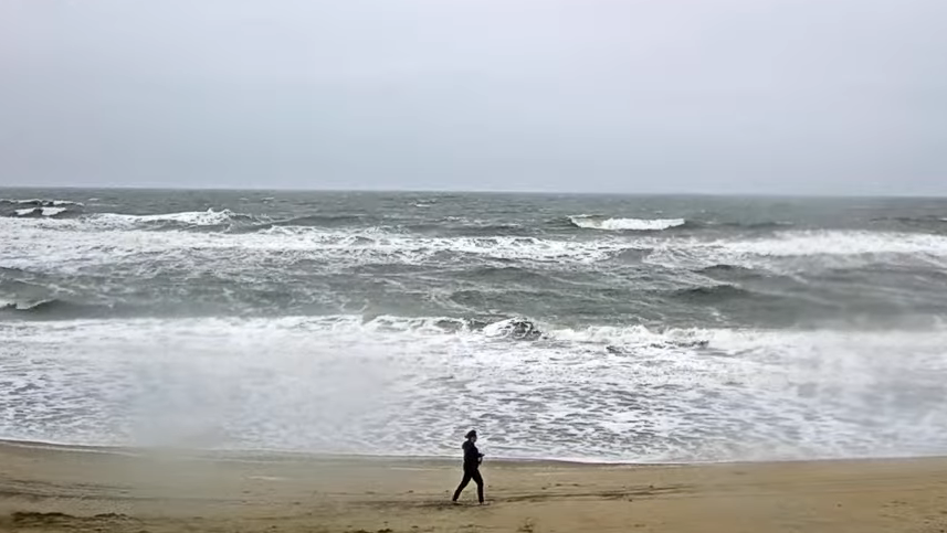
A High Surf Advisory for breaking waves of 6 to 10 feet remains in effect along the Outer Banks through Sunday morning, but all other advisories have been dropped.
Minimal impacts to travel have been reported, as winds dropped enough on Saturday to allow Ocracoke ferry service for vehicles to resume along the Hatteras Inlet and Pamlico Sound routes. However, the Ocracoke Express passenger ferry did not run.
No ocean overwash has been reported, but the stiff breeze continues to blow sand across N.C. 12 between Oregon Inlet and Rodanthe.
Travel along the four-wheel drive area north of Corolla to Swan Beach and Carova could remain a problem around high tide on Sunday, which is at 3:09 p.m.
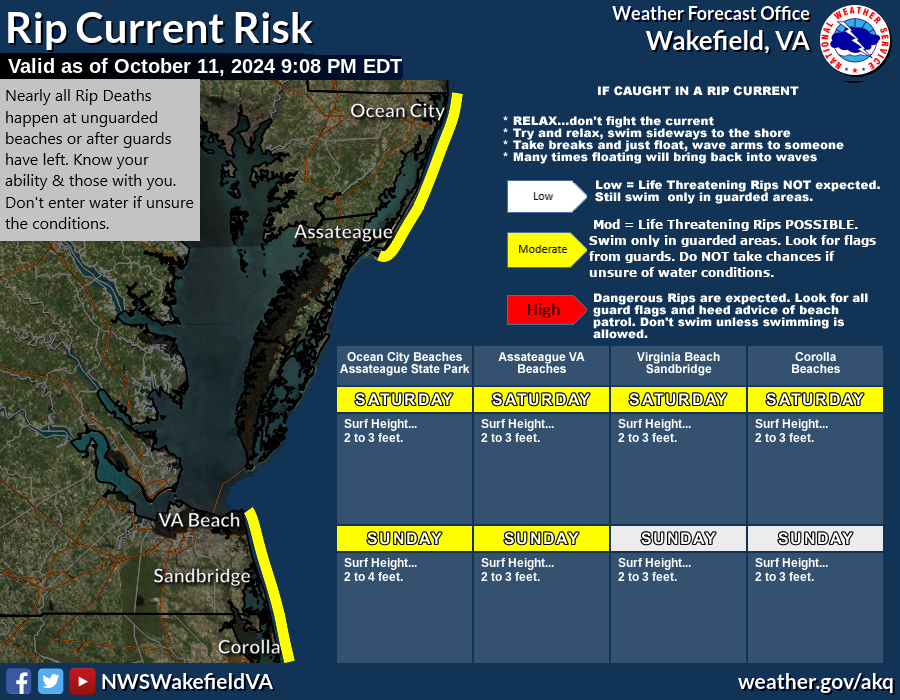
A high risk of rip currents is expected to continue through the weekend, and everyone should stay out of the ocean.

Light-to-moderate rainfall is forecast to continue on Sunday, with the possibility of a few thunderstorms, and warmer temperatures in the low 70s. Memorial Day looks to be partly sunny, with a few thunderstorms in the afternoon and highs in the mid 70s.
National Weather Service seven-day forecasts for:
LIVE data from flood gauges at key locations throughout North Carolina, including automated email and text alerts, visit https://fiman.nc.gov/
Sign up for emergency alerts from Dare County and its municipalities. Beach safety and rip current information can be found at LoveTheBeachRespectTheOcean.com.
Currituck County provides beach safety and emergency updates for Corolla and the mainland via Currituck Alert.
For the latest images from NCDOT traffic cameras on the Outer Banks and northeastern North Carolina, visit: https://wobx.com/2022/06/01/outer-banks-northeastern-north-carolina-traffic-cameras/.
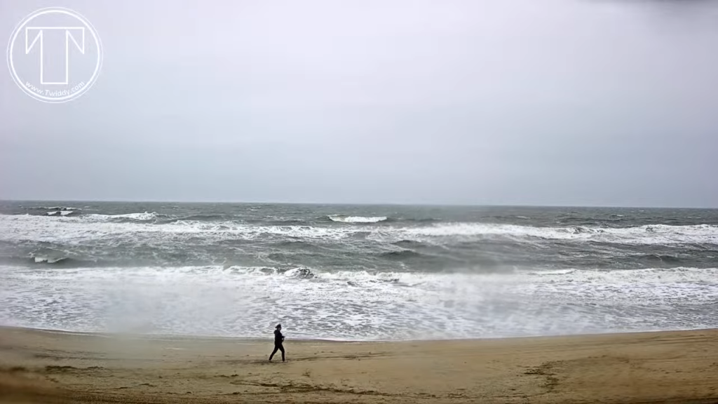
LIVE video from Kitty Hawk, courtesy Twiddy & Co.:
LIVE video from Rodanthe, courtesy RodanthePierLLC.com:
Click to watch LIVE video from Corolla, courtesy Currituck County/WebCOOS